

A few years ago, before this blog was hosted on Substack, it could be found on its own lonely website, where about three people read it. During the transition, many of those old posts were lost, including one on Clouds. I liked that post, and I can never remember the names of the different types of clouds when I see them, so I decided to write it again.
I wrote it the first time because I had just read Jon Moolamem’s book Serious Face (which I highly recommend), and one of his essays got me thinking about clouds. I’ve always loved looking at them and imagining that their shapes looked like something (“That one’s a bear.” “No, it’s a dog.”), but I haven’t been one of those folks who could tell what types of clouds I was seeing, or what the types meant.
When I am in an airplane, the clouds are endlessly fascinating. At times they seem to go on forever.
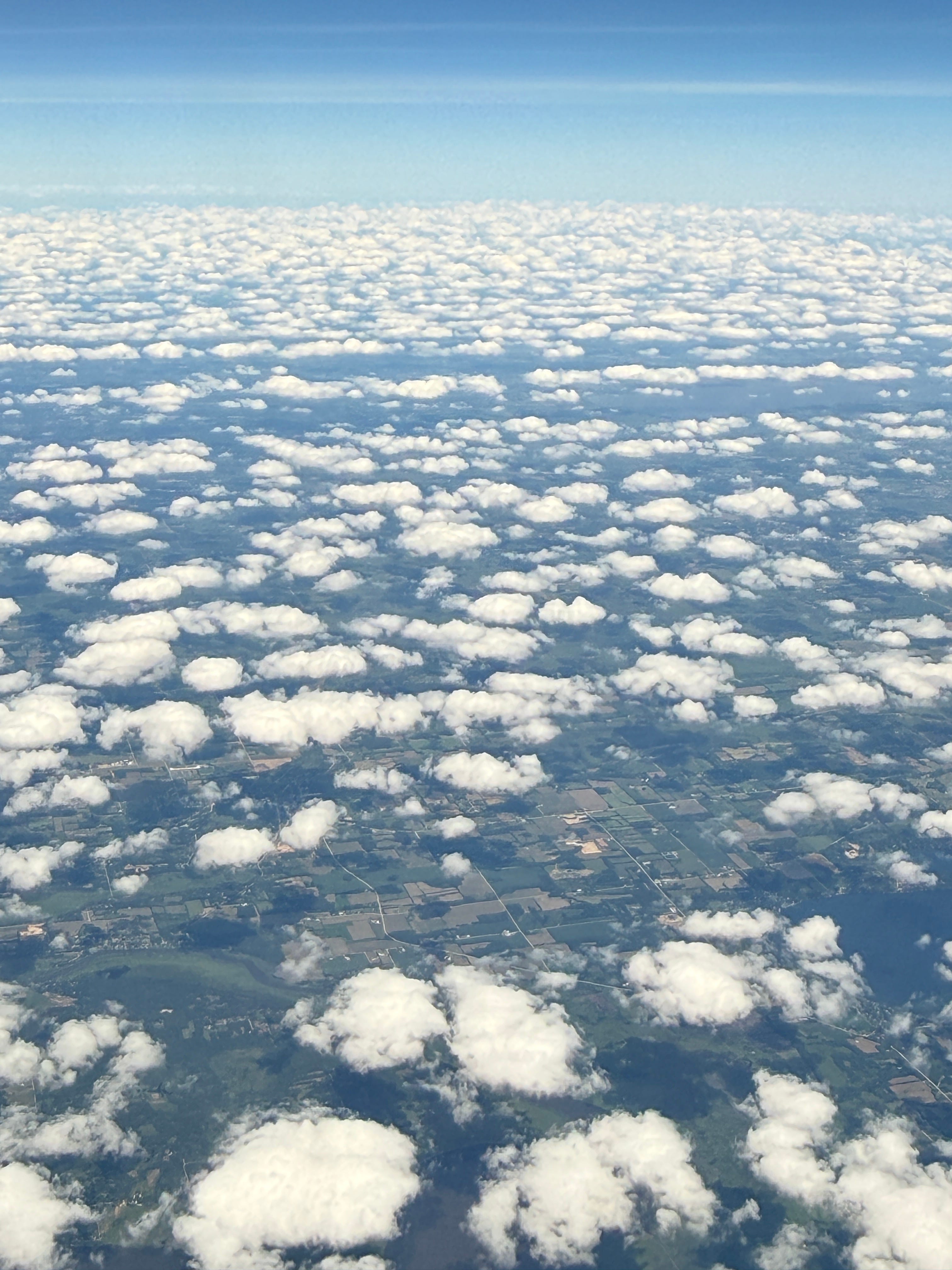
I always thought that clouds were made of water vapor, but that’s not exactly true. Water vapor is pretty much invisible, but as it rises on warm air currents and cools, it turns into tiny water droplets or ice crystals, which are so small that they float in the air. That’s what clouds are made of.
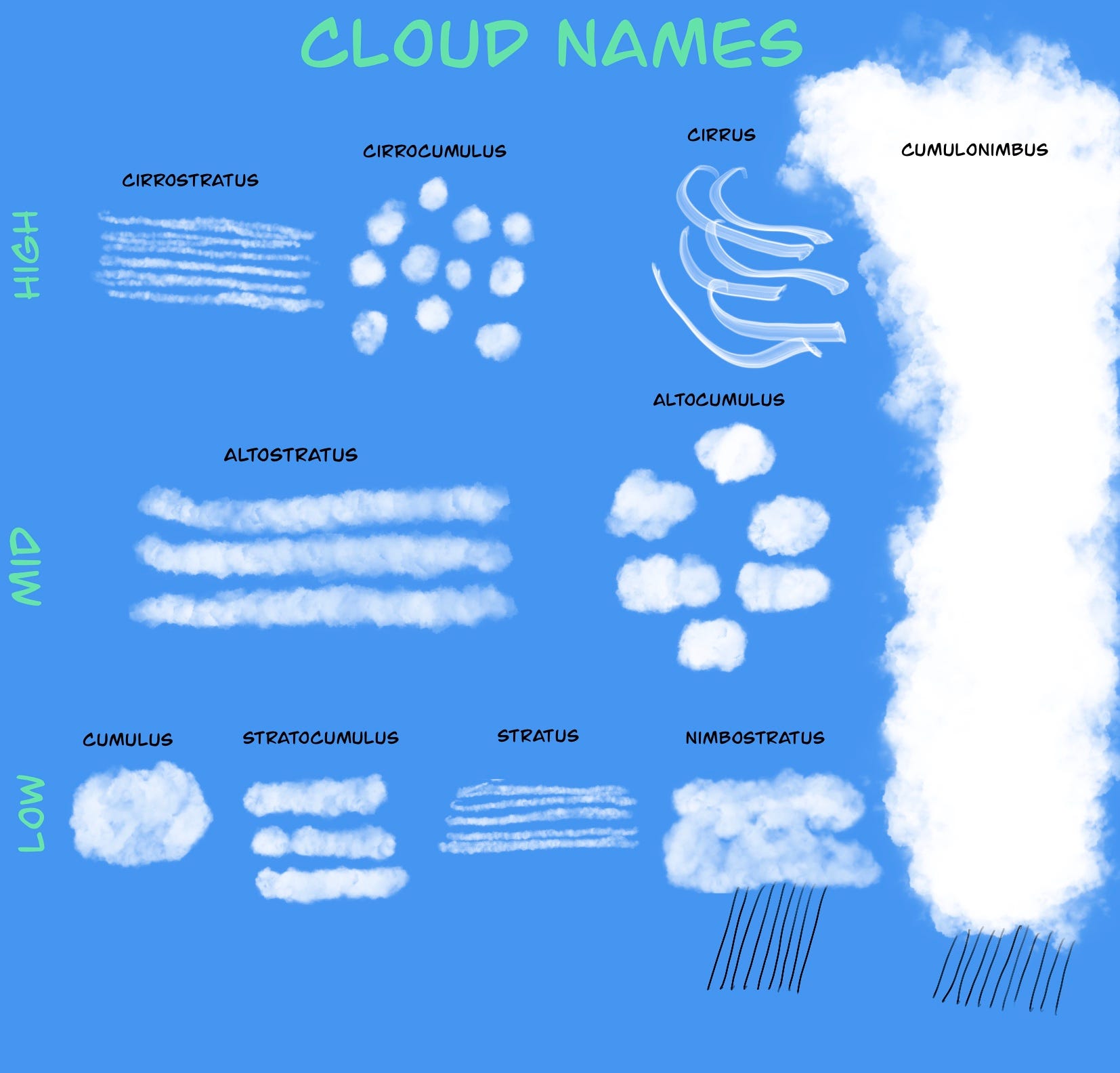
Clouds are classified into three main groups, with lots of sub-groups. The main groups vary by the height of the cloud.
Cirrus: 18,000 feet or higher
Alto: 6,500 to 18,000 feet
Stratus: below 6,500 feet
The highest group, Cirrus clouds, usually are related to good weather. Cirrostratus clouds are thin enough that you can see light through them, and they often cover the whole sky. Cirrocumulus clouds are little white puffs that look like cotton balls, and are often lined up in rows.
Of the Alto group, Altostratus clouds are darker, usually gray or blue, that are associated with storms. Altocumulus clouds look gray and puffy, and are normally found in groups. They can point to upcoming thunderstorms.

The lowest cloud group are the Stratus clouds, which can cover the entire sky with what looks like fog. They may be accompanied by light drizzle. Stratocumulus clouds are rows of gray clouds with blue sky visible between them. Little precipitation comes from these formations, but they can turn into Nimbostratus clouds, which can bring rain or snow. Nimbostratus clouds are still low, but they look like a gray, wet layer.
Others
Cumulus clouds are individual puffy clouds that can start low and move higher as they grow. When they get much larger they can form Cumulonimbus clouds, which can span several height levels, and bring heavy rain or snow. These are the clouds you see during thunderstorms.

I only recently became aware of Cumulonimbus clouds that can be generated by a large wildfire. These are called Pyrocumulonimbus clouds, which have two nasty properties: they can produce lightning, which can start new fires, and they tend to create high winds that can fan the flames.
I still look up and think, “That looks like a car.”

I share your interest in clouds. The Great Plains are a great environment for some examples. Here’s one of my own favorite photos.